
The fastest way to a usable multi-stop sightseeing route is a map-based itinerary builder that sequences your stops and splits them into days automatically. Skip the spreadsheet and skip the twelve open browser tabs. Feed a tool your start point, end point, and must-see stops, and let it generate a draft route you can tweak from there.
Here's why this works:
- It handles the sequencing math (which stop comes next, in what order) faster and more accurately than eyeballing a paper map.
- It gives you real time estimates for driving or walking between stops, so your "quick" day doesn't quietly become a 10-hour slog.
- Most tools export the result for offline use, so you're not stuck reloading a webpage in a canyon with no signal.
Your next move: open a route planner, drop in your anchor stops, and generate a draft. You'll edit it. Everyone does. But you'll be editing something real instead of starting from a blank page.
Key Takeaways
The fastest, most reliable path to a workable multi-stop sightseeing route combines geographic clustering, realistic time buffers, and a tool that can adjust plans live when conditions change.
| Point | Details |
|---|---|
| Start with constraints | Lock in trip dates, daily driving limits, must-see anchors, and group needs before mapping stops. |
| Cluster, don't crisscross | Group stops by geography to cut backtracking, the biggest hidden time cost in sightseeing routes. |
| Buffer by context | Add 15 to 20 minutes per stop beyond raw travel estimates. |
| Prepare for offline use | Download maps and export PDFs or GPX files before entering low-connectivity areas. |
| Use Planytera for complex trips | Planytera generates sequenced, day-split itineraries with offline access and live adjustments built in. |
Table of Contents
- What features matter most in sightseeing route planning?
- How do you build a multi-stop sightseeing route step by step?
- How can you optimize stops to save travel time?
- How do you handle changes and stay on track while sightseeing?
- How do you customize a route around your own interests?
- When should you plan a route yourself instead of using AI assistance?
- Try Planytera to build your next sightseeing route in minutes
- Sources
What features matter most in sightseeing route planning?
Not every route planner earns a place on your phone. Some are glorified pin boards. Others actually think like a trip planner. Here's what separates the two, and why each feature matters more than it sounds.
- Unlimited stops. A real multi-stop planner should let you drop in many stops without arbitrary limits.
- Multi-day splitting. A single sprawling route is useless. You need the tool to break it into Day 1, Day 2, Day 3, with logical daily distances, not an arbitrary chop in the middle of nowhere.
- Transport-mode settings. Driving, walking, cycling, and public transit all move at wildly different speeds. A planner that assumes you're driving when you're actually walking a dense old town will wreck your schedule.
- Accurate drive and walk times. Generic straight-line distance is nearly worthless in a city with one-way streets or a coastline with a single mountain road. You want real routing, not guesswork.
- Point-of-interest (POI) discovery. The best tools suggest nearby attractions you didn't know to search for, pulling from community-built map data like OpenStreetMap, which powers routing and points of interest across countless mapping apps.
- Offline maps. Cell coverage disappears exactly when you need it most, usually somewhere scenic and remote.
- Export and print options. PDF, GPX, or a simple shareable link matters when you're coordinating with a travel partner who isn't glued to the same app.
Beyond the technical checklist, usability makes or breaks daily use. A combined map-and-itinerary view, where you see your pins and your schedule side by side, beats toggling between two separate apps, a preference echoed in travel-app roundups that favor integrated map and itinerary interfaces for exactly this reason. Quick drag-and-drop reordering and simple collaboration for group trips round out the list.
Finally, look for data and safety features: live alerts for closures or delays, local advisories, and, if you're driving electric, EV charging support built into the route.
Pro Tip: Test any planner on a short trip first, three or four stops, before trusting it with a two-week itinerary. You'll spot its blind spots fast, and cheaply.
How do you build a multi-stop sightseeing route step by step?
Building a route that actually holds up on the ground follows a predictable sequence. Skip a step and you'll feel it, usually around 4 PM on day two, standing in a parking lot wondering why you're an hour behind schedule — a situation easily avoided if you consider options like Best Day Trips from Reykjavík when planning your transfers and tours.
1. Nail down your constraints first. Before you touch a map, write down your trip dates, your comfortable daily driving limit, your true must-see anchors (not "maybe" stops), your pace preference, who's traveling with you, any accessibility needs, and your rough budget. This list becomes your filter for every decision that follows.
2. Gather your stops. Mix your own must-sees with trusted sources: guidebooks, local recommendations, and community map data. Import lists or drop pins directly onto a working map rather than keeping them in a separate notes app, which is where good ideas quietly get lost.
3. Sequence logically. Cluster stops by geography instead of the order you thought of them. Respect posted opening hours (a museum that closes at 3 PM shouldn't sit at the bottom of your list). Pick a sensible direction of travel for the day so you're not zigzagging across town.
4. Divide into days. Assign realistic time windows to each stop, including buffers. Estimate arrival and departure times, and be honest about how long you actually linger somewhere you love, not the fifteen minutes a brochure suggests.
5. Validate your travel-time estimates. Compare the planner's numbers against local conditions. A five-mile walk through a hilly old town takes far longer than a five-mile highway drive. Large route compendia that catalog iconic long-distance drives consistently stress staging: breaking a long loop into sustainable daily legs rather than one heroic marathon day. Add contingency time everywhere; 15 to 20 minutes per stop is a reasonable starting buffer.
6. Export and back everything up. Save offline maps before you leave home. Export a PDF, GPX file, or CSV as backup. Share the route with anyone traveling with you so nobody's improvising from memory.
A few habits make this whole process smoother:
- Build routes for multi-day trips the way seasoned planners do, in legs rather than one giant blob, similar to how a 7-day Iceland ring road itinerary gets broken into digestible daily segments.
- Recheck opening hours the week before departure. They change more often than you'd think, especially outside peak season.
- Keep one buffer day in longer trips for the inevitable "we want to stay longer here" moment.
Follow this sequence and your itinerary stops being a wish list and starts being something you can actually execute.
How can you optimize stops to save travel time?
Route optimization isn't about cramming more into a day. It's about cutting the wasted minutes that add up to hours you'll never get back.
Start with clustering. Group stops into compact loops instead of crisscrossing a region multiple times. If your morning stop and your evening stop are twenty minutes apart, but you've scheduled three unrelated detours in between, you're backtracking, and backtracking is the single biggest time thief in sightseeing route planning. On a long driving day, break it up with one well-placed scenic stop rather than pushing straight through; it resets everyone's energy and usually costs less time than a rushed group grumbling in the back seat.
Timing matters as much as sequencing. Popular attractions get crushed between 10 AM and 2 PM. Shift your visit to opening time or the last two hours before close, and you'll often see the same sight with a fraction of the crowd.
Buffer time should flex with context based on stop type and setting to allow for parking, walking, detours, photos, and visits to major attractions.
A useful real-world reference: Iceland's Golden Circle loop runs roughly 230 kilometers and is commonly driven in a single day, but that estimate assumes reasonable stop durations already factored in, not a bare drive-time number with nothing added.
Transport mode should shift with terrain, not stay fixed for the whole trip. Walk dense city centers where parking is a headache and everything is close together. Drive rural stretches where distances stretch out and public transit is thin. Mixed-mode legs, like a scenic ferry crossing paired with a driving segment, need their own buffer for boarding and disembarking, something well illustrated by itineraries built around ferry-dependent legs in the Norwegian fjords.
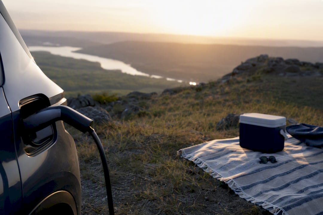
If you're driving electric, plan charging stops around dwell time, not just battery percentage. Choose chargers near a café, viewpoint, or short trail rather than a bare parking lot, so the thirty minutes you're plugged in doubles as sightseeing time instead of dead time.
How do you handle changes and stay on track while sightseeing?
Even a well-built route runs into reality: a museum closes unexpectedly, a storm rolls in, a ferry gets delayed. What separates a smooth trip from a stressful one is preparation, not luck.
Before you leave, do the boring but critical prep work:
- Download offline maps for your entire route, including any rural stretches. Tools built on open mapping stacks like OpenMapTiles make this straightforward, letting you cache custom map styles for exactly the region you're visiting.
- Export your itinerary as a PDF or GPX file so it survives a dead phone battery or a lost signal.
- Note two or three backup stops per day in case your primary plan falls through.
- Save local emergency and venue contact numbers somewhere you can access offline.
When something goes sideways, resequence rather than panic. If a stop is closed, swap in your backup and adjust your buffer for the next leg. If weather turns, prioritize your must-see anchors and cut the "nice to have" stops first; you built that priority list in step one for exactly this moment. Seasonal daylight and road conditions can shift plans dramatically, a point Lonely Planet makes clear when comparing summer and winter driving conditions on routes like the Golden Circle, where a 4WD recommendation in winter isn't optional advice.
This is where a flexible planning tool earns its keep. Planytera lets you edit itineraries on the fly, pulls in live travel guidance so you're not blindsided by a closure, works offline once your maps are cached, and supports collaborative editing so your whole group sees the same updated plan in real time. A built-in trip journal means the detour you took because of a closed road becomes a memory you actually documented, not a frustration you forgot by dinner.

Pro Tip: Sync your offline maps and itinerary the night before you lose reliable signal, not the morning of. Rural cell coverage has a way of vanishing exactly when you're trying to download something.
How do you customize a route around your own interests?
A generic "top ten sights" list is a starting point, not a finished itinerary. The stops that make a trip memorable are usually the ones tailored to what you actually care about, not what a listicle says everyone should see.
Start by naming your real priorities before you open a map. Are you chasing food, architecture, hiking, photography, or history? A food-focused traveler should weight market visits and local restaurants over a fourth cathedral. A hiker needs trailhead access and daylight hours factored into every day's schedule, not just drive times between towns.
Group travel adds another layer. Families with young kids need shorter stretches between stops and playground or rest-stop options built in. Seniors may prioritize step-free access and shorter walking distances between parking and attractions. Solo travelers often have more flexibility to change plans mid-day, which means a route that's easy to reshuffle matters more than one that's rigid but efficient.
Meals and rest deserve real slots on the schedule, not an afterthought squeezed between attractions. Block 60 to 90 minutes for lunch, not fifteen rushed minutes at a gas station, and treat that block as a legitimate stop, not a compromise.
The tools worth using let you weight these preferences directly, rather than forcing you to manually reorder a generic list every time your interests shift. That's a meaningful advantage over a static, one-size-fits-all itinerary template.
When should you plan a route yourself instead of using AI assistance?
Do it yourself when the trip is small enough to hold in your head: a single day, a handful of stops, one mode of transportation. Total control over every stop has real value when you want to wander a neighborhood on instinct rather than follow a schedule someone (or something) else generated.
That instinct breaks down fast once complexity creeps in. A ten-day trip with mixed transport, a group with different priorities, or a route spanning multiple countries turns manual planning into hours of cross-referencing opening hours, drive times, and everyone's wish list. That's exactly where AI-assisted planning earns its place: it handles the sequencing and time-math grunt work so you can spend your planning hours on the decisions that actually need a human, like which detour is worth the extra ninety minutes.
The right balance isn't choosing one approach forever. It's matching the tool to the trip. Let AI-generated planning tools like Planytera draft the skeleton of complex, multi-day, multi-person trips, then spend your own energy refining the parts you care about most. Leave room in every plan for the unplanned coffee shop or the trail you spot from the car window. The best itineraries have structure with slack built in, not a rigid script.
— Dom
Try Planytera to build your next sightseeing route in minutes
Planytera turns the entire workflow above, gathering stops, sequencing them, splitting days, adding buffers, into a single generation step. Tell it your interests, your pace, your budget, and your must-see anchors, and it builds a day-by-day plan instead of leaving you to stitch one together from six browser tabs.

Say you've got five must-see stops and two days. Planytera sequences them by geography, splits them into a realistic Day 1 and Day 2, adds time estimates that account for your chosen transport mode, and, if you're driving electric, slots in a charging stop near a café rather than an empty lot. The same trip stays editable afterward: swap a closed attraction for a backup, resequence a day on the fly, and share the updated plan instantly with anyone traveling with you.
Offline maps mean the plan still works when you lose signal on a rural stretch. Live travel guidance flags disruptions before they wreck your afternoon. And the built-in trip journal captures the detour stories you'd otherwise forget by the time you're home.
Generate a sample trip on the Planytera landing page and see your own must-see list turned into a working route before you commit to a subscription.
Sources
- OpenMapTiles
- OpenStreetMap copyright & data
- A guide to driving Iceland’s Golden Circle - Lonely Planet
- Golden Circle Iceland: Full Route, Stops and Map